NEWS
Subsea site survey
Writer: admin Time:2024-06-20 15:20:24 Browse:450℃
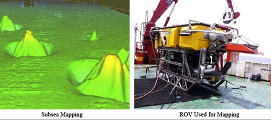
A subsea site survey must be conducted before offshore activities like drilling and installation to obtain accurate information on the seabed's bathymetry and properties. Detailed seabed mapping, involving precise bathymetry, can be achieved using a seabed reference system equipped with differential pressure sensors and acoustic data transmission, which can be deployed and retrieved by an ROV. Alternatively, an ROV fitted with a multibeam echo sounder (MBE) or a side-scan sonar (SSS), as illustrated below, can perform seabed mapping. Additionally, a sub-bottom profiler (SBP) may be utilized to evaluate the seabed's properties for the foundation of offshore installations.
FLOAT X provide all kinds of ROV buoyancy module for all kinds of ROVs.
CATEGORIES
LATEST NEWS
CONTACT US
QQ:
Phone: Whatsapp: +86 15163359933
Tel: Whatsapp: +86 15163359933
Email:
Add: No.08, Zhaoyang Road, Rizhao City, Shandong Province, China